Parking Open Data — Winning the Codemotion Rome Hackathon
How four people built a sensor-driven parking prototype in less than 24 hours and won three awards at Codemotion Rome 2013.
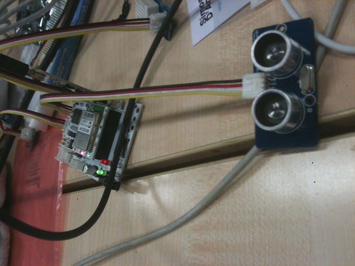
On 22 and 23 March I attended Codemotion Rome 2013, a major Italian event for the technology community. Alongside an excellent programme of workshops, it gave me the chance to join the hackathon organised by WHYMCA: The Mobile Revolution.
The hackathon was a continuous 24-hour building session. Participants combined technologies supplied by sponsors with their own tools to create experimental prototypes.
The team
I met some exceptional people and formed a new team with:
- Federico Cappelli
- Daniele Guiducci
- Daniele Verducci
- Giuseppe Toto
After more than three hours of brainstorming, we built Parking Open Data in less than a day. The prototype won three awards:
- first prize for the best hack in the Codemotion competition;
- first prize in the OpenVision–Skyport category;
- third prize in the Open Data category.
The theme of the event was improving quality of life.
What was Parking Open Data?
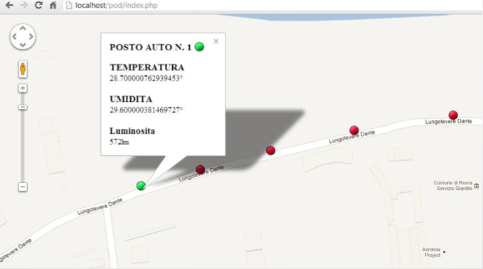
Parking Open Data was a business-intelligence system for managing parking spaces. Each space would have a sensor capable of detecting whether a car was present and reporting that state to a central server. The device also collected ambient light, temperature, and humidity.
The server aggregated the readings and made them openly available on the internet, allowing other people to build applications on top of the same data.
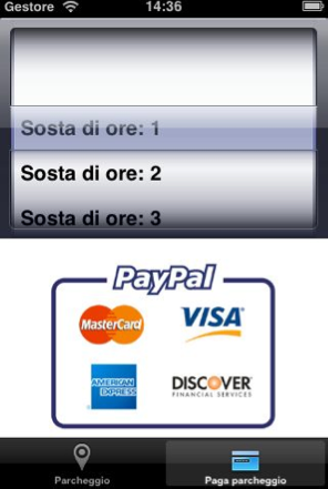
We created both a native iOS app and a web app. Drivers could locate free spaces and filter them using secondary information, such as whether a space was in the sun or the temperature of the asphalt—a preference that could change with the season. The prototype also included PayPal payments, avoiding the search for change at a parking meter.
Why make the data open?
Public sensor reports could be analysed like a small data warehouse. Even on their own, they could reveal patterns in parking demand, weather, location, and time of day. Combined with other public datasets, they could help test more complex hypotheses—for example, the relationship between traffic intensity and parking saturation.
That evidence could support practical decisions: increasing public transport on a busy route, or lowering the price of spaces slightly farther away to distribute traffic more evenly. Drivers received an immediate service, while city administrators gained data that could help them understand a wider urban problem.
Thanks to Professor De Carolis from the Department of Computer Science, whose earlier work gave me the initial inspiration to think about parking.
Prototype technology
- Flyport hardware from OpenPicus/OpenVision
- native iOS
- Spring 3 and Hibernate 4 with Maven
- JavaScript and HTML5
- Google Maps API